Utilities
Well Log Viewer
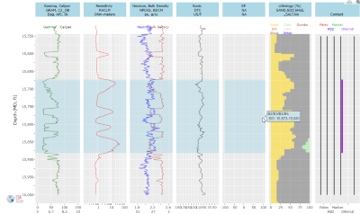
The Well Log Viewer displays the most important curves from all logs of a well, as defined...
Plat Map
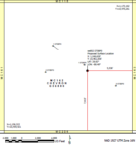
The Plat Map was designed to create a quick map of a block and show the location of a new permit...
News Feed
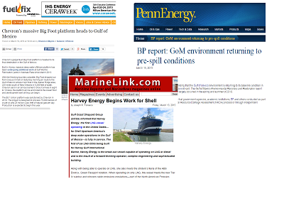
GOMsmart tracks current events in the Gulf of Mexico and keeps you updated...
Nickname Lookup
The Nickname Lookup page displays all of the field, discovery or prospect nicknames...
Update Status
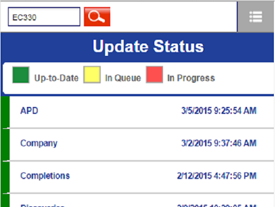
The Update Status page displays the date/time of the last update for each dataset....
Well Log Viewer
The Well Log Viewer displays the most important curves from all logs of a well, as defined by input from petrophysicists. The viewer is interactive and integrates extra data such as paleo picks, completion intervals and the casing program. Three different types of logs are available:
- Geology and Geophysics log (G&G): Gamma, Resistivity, Neutron and Bulk Density, Sonic, Spontaneous Potential, Caliper and Lithology, with completion intervals and paleo observations.
- Mud log: C1, C2, C3, C4I/C4N, C5I/C5N, Rate of penetration, Total Gas, Wetness, Mud Temp In/Out and Lithology, with completion intervals and paleo observations.
- Mechanical log: Rate of penetration, RPM, Weight on bit (Surface/Down hole), Torque (Surface/Down hole), ECD, ESD, Mud In/Out, Pore Pressure, Lithology, Gamma, Flow Rate In, Pump Pressure and Annular Pressure, with casing, completion intervals and paleo observations.

Plat Map
The Plat Map was designed to create a quick map of a block and show the location of a new permit to submit to BOEM. The Plat Map can also be used to generate a quick map of wells, platforms, pipelines and field outlines within a block. The map is projected into the proper coordinate system for the area and downloaded as a PDF ready to print.
When setting the location of a new well, foot offsets are calculated from the input lat/lon values. The map is saved at a 1" = 2,000' scale (1:24,000). A variety of inputs are available:
- Title and company name.
- Color vs. black-and-white maps.
- Well name, suffix, depths and location information.
- Other datasets to display: leases, wells, platforms, pipelines and/or field outlines.

News Feeds
GOMsmart tracks current events in the Gulf of Mexico and keeps you updated on the latest news. Various reputable sources are scanned hourly and all of the latest information is presented in a single page for easy viewing.

Nickname Lookup
The Nickname Lookup page displays all of the field, discovery or prospect nicknames within the GOMsmart system. This page makes it easier to locate a particular project if the protraction area and block are not known or readily available. Choosing a nickname, such as BULLWINKLE, will open the Main page to block GC065. Remember, nicknames can also be typed into the search box at the upper left of every page.
Update Status
The Update Status page displays the date/time of the last update for each dataset. Each dataset name can be clicked to see more information on the data included within the dataset.


