ESA GOM3 Tools
Cartographic
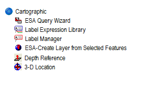
Cartographic tools provide easy interaction with the maps and the related data.
- ESA Query Wizard
The Query Wizard creates a selection of data filtered by the query provided. It opens up the form for easy query definition. To use it- Choose either Select by attribute or Definition query
- Select the layers and the method
- Define the Where clause of your query in the space provided and click apply
- Label Expression Library:
The Label Expression Library consists of pre-formatted labels associated with the features. Once chosen, the labels are displayed on the map for the features. - Label Manager:
The Label Manager is useful to modify label sizes and symbology. - ESA-Create Layer from the Selected Features:
This tool creates a new layer based on the selected data and adds it to the map. - Depth Reference:
The Depth reference tool (available only for ArcScene) allows to set a reference plane in the scene at the specified depth. - 3-D Location:
The 3-D Location tool (available only for ArcScene) provides the location information of the viewer in the scene.

Exports
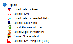
The tools in this category are useful to export the Map/Scene to various formats for easy reuse, sharing, analysis and presentations.
- Extract Data by Area:
Extracts data (Completions, Surveys, Paleo, Well tests etc.) by area. Gives a nice form for the selection of area block and delimiter format for the export. - Export to KML:
Exports the data to Keyhole Markup Language - Extract Data by Selected Wells:
From a “Wells” layer, data can be extracted from the selected wells in the layer. Options are available to select the delimiter and data type (Completions, Surveys, Paleo, Well tests etc.) - Export to GeoFrame:
Exports the data to GeoFrame format - Export Attributes to Excel:
Exports the selected features in a layer to Excel spreadsheet. If none selected, all features are exported. - Export map to PowerPoint:
Exports the map in view to a Powerpoint presentation format. - Convert Shape to text:
Converts the selected feature shapes to text and saves as CSV. - Export to SMT/Kingdom (Beta):
Exports the data in SMT/Kingdom format.

Search
Search tools makes it easy to search information from the available data.
- Name Index:
A sorted name (nickname) index of Fields, Discovery and Prospects. On Selection the map zooms to the selected block. It can also be used to Export the complete list in a CSV format. - ESA Data Search:
Search for a Data from selected/all Datasets. Can be used to search for Column Names or Data Values. The searched dataset then can be added to the map.

Utilities
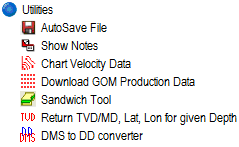
- Autosave File:
up to auto save your work in a given time interval. - Show Notes:
Highlights the features on the map which contain Notes associated with them. Notes can be accessed and created using the hotlink tool. - Chart Velocity Data:
Exports to Excel a Chart of Velocity Survey with Depth and time as Y and X axis respectively. - Download GOM Production Data:
Download all the compressed production data aailable at GOM3 - Sandwich Tool:
The purpose of the Sandwich tool is to assign a value from a raster (eg. depth) to points that fall within the raster's extent. The Sandwich Tool can be run for a series of rasters, defining which points are above, below and between different rasters. - Return TVD/MD, Lat, Lon for given Depth:
Once given the API number, this tool Returns the True Vertical Depth/ Measured Depth along with the coordinates. - DMS to DD converter:
Degree Minutes Seconds to Decimal Degrees converter and Vice Versa.


